Úvodní stránka / Průvodce aplikací /

Breakfast Brief: Northeast storm bring stormy conditions and big East cooldown

9:00
14. října 2024

Breakfast Brief
Big East cooldown, Northeast storm

A powerful storm system is kicking off the week with turbulent weather, delivering stormy conditions and even an early taste of winter to parts of the Great Lakes and Northeast. Meanwhile, a national mix of summer heat and fall cooldown will be felt across the country.

On Monday, a strong autumn storm is sweeping across the lower Great Lakes and into the Northeast, bringing widespread rain and gusty winds. In interior parts of the Northeast, especially in higher elevations and during the cooler overnight hours, some snowflakes are possible. Accumulating snow could occur across the highest peaks of the Adirondacks, Green, and White mountains tonight.

1/2
The WeatherRadar shows isolated pockets of snow in the higher elevations of interior Northeast on Monday, October 14, 2024

Did you know?

On this day in 1981, an unseasonal October snowstorm hit the central and northern Rockies briniging heavy snow and unusually cold temperatures. Up to two feet of snow fell in the higher elevations causing power outages and travel disruptions.

This same system is pushing a potent cold front through the eastern half of the U.S., replacing the unseasonably warm weekend temperatures across the Midwest, Tennessee Valley, and Mid-Atlantic with a sharp drop. Cities like Lexington, Ky., Nashville, Tenn., Charlotte, N.C., Richmond, Va., and Memphis, Tenn. may experience temperature drops of up to 20 degrees by Monday morning. This cooling trend is expected to continue through midweek, extending as far south as the Deep South.

West of the Rockies and in Texas, however, an entirely different story is unfolding. Much above-normal temperatures will persist, with the northern High Plains and Rockies seeing highs in the 80s, well above seasonal norms. In Texas, particularly the eastern part of the state, temperatures are expected to soar close to 100 degrees on Monday.

Tropical update:

In the tropics, a tropical disturbance is moving the the tropical central Atlantic. It could develop into a depression as it approaches the Greater Antilles this week.

News we are covering today:

  • Storm system shifting across the Northeast

Did you miss these?

Once in a lifetime comet in viewDále doporučujeme
Hurricane Milton-A record tornado makerDále doporučujeme
Auroras dazzle the night skyDále doporučujeme

App news & updates:

It's never too early to prepare for the winter season! Is your blizzard kit in order?

Federico Di Catarina
Více k tématu
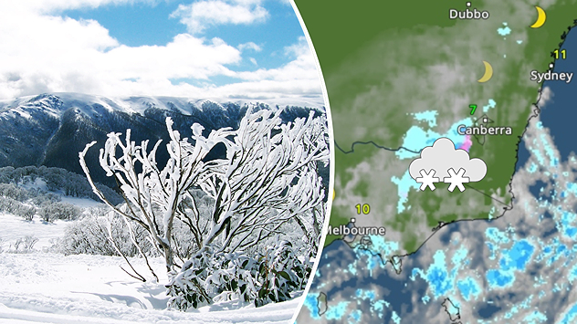
Dvoudílný obrázek: vlevo zasněžená horská krajina s jinovatkou, vpravo meteorologická mapa se symbolem sněhu a teplotami blížícími se nule v jihovýchodní Austrálii
pondělí 28. července 2025

Zimní bouře

Vydatné sněžení v Australských Alpách
úterý 29. července 2025

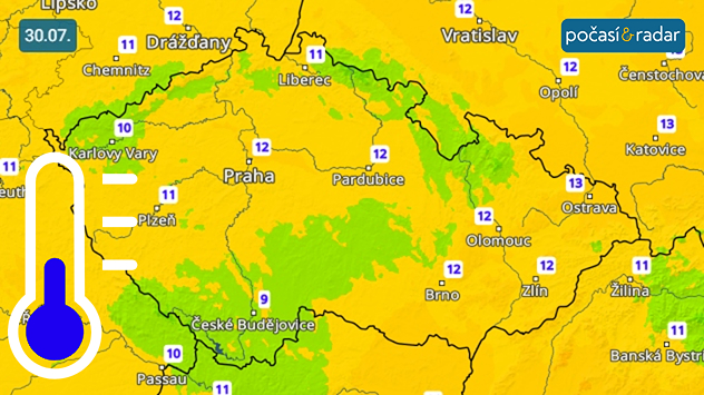
Čeká nás chladná noc

Teploty místy poklesnou pod 10 °C
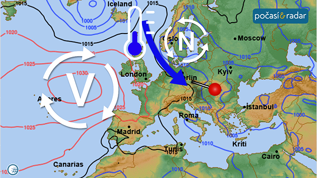
Synoptická mapa Evropy v úterý 29. 7. : České počasí určuje chladné a vlhké severozápadní proudění, které se k nám dostává mezi tlakovou níží nad jihem Skandinávie a tlakovou výší nad Azorskými ostrovy.
úterý 29. července 2025

Severozápadní proudění

Nižší teploty, velká oblačnost, přeháňky
Všechny zprávy o počasí
Mohlo by vás také zajímat
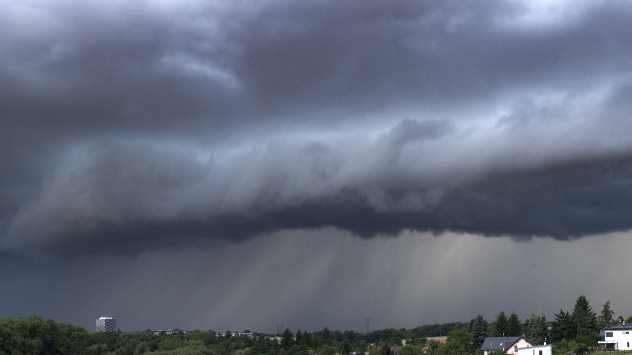
Záběr na přicházející bouřku.
čtvrtek 31. července 2025

Bouřky u Prahy

U Prahy se objevil výrazný shelf cloud
úterý 17. června 2025

Poničené kempy

Přes Istrii se prohnaly silné bouřky
neděle 29. června 2025

Tepelná kupole

Do Evropy míří vlna veder
Všechny příspěvky
Počasí & Radar

www.pocasiaradar.cz

facebookinstagramtikTokKontaktlinkList
Ochrana dat | Impresum | Prohlášení o přístupnosti